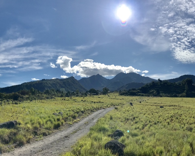
With its 3475 meters above sea level the Baru Volcano gives a show of beauty throughout its climb
The Baru Volcano with its height of 3475 meters above sea level becomes the highest point of the Republic of Panama and also at the highest point of southern Central America.
Baru Volcano is undoubtedly one of the most important attractions of the Chiriqui Highlands, it is scientifically estimated that its last eruption was 400 and 500 years ago, also some scientists estimate that it could erupt in the future, since it is considered an active volcano.
On the west side of the Baru Volcano are the communities of Paso Ancho, Volcan and Cerro Punta, from the community of Paso Ancho only foot expeditions are started (you can not get on this route with pick-ups, four-wheels, etc). On this route you climb a fairly steep trail with a walk between 7 and 12 hours depending on the conditions of the person. A young person of average conditions can make a standard time of 7 hours, while a person with few physical conditions can take 12 hours from the Community of Paso Ancho to the top of the Volcano.
On the east side is the community of Boquete, on this side of the Baru Volcano you can get on 4x4 cars or off-road cars, since the street are of stones and some mud sides.
On the south side of Baru Volcano is the community of Potrerillos, where there are no appropriate trails to climb the volcano, however there may be some roads that are known by locals, but it is not recommended for people who do not know the area.
Geo-politically the Baru Volcano is shared by the Tierras Altas, Boquete and Boquerón Districts, all of them in the Core of Chiriqui province.
The minimum temperatures that can reach the top of Baru Volcano is lower than 0ºC, mostly between the months of December to February. Historically it has been mentioned that the summit of Baru Volcano years ago remained covered with snow during these months, however nowadays you can see frost when its temperature drops a lot during the nights.

 English
  Spanish